Building date:
Original use:
Corner structures:
Mortar application and content:
Types and uses of stones:
Types and choice of windows:
Structures with similar masonry details:
Masons who worked on building:
Unique features:
Map views courtesy Google Maps. Location is only known as intersection of Plank Rd. and Macedon-Ontario Rd., NY 350.
Town of Walworth and Wayne County 1978 Highway Maps
"The Cobblestone Houses of Upstate New York", compiled by Dorothy Wells Pease. Research done in collaboration with Hazed B. Jeffery, supplemented with material furnished by Carl F. Schmidt, 1941. Reference the eleventh paragraph on page 32.
Editor's Note: There has not been any confirmation as to the actual location of this structure. There is a contradiction as to the location. The photograph appears on page 16 of the book "Cobblestone Landmarks of New York State", 1978, by Olaf William Shelgren, Jr., Cary Lattin, and Robert W. Frasch, Photographs by Gerda Peterich. The photograph caption located the ruined wall in the Webster, Monroe County area. However, a brief handwritten notation on the photograph envelope in the Gerda Peterich photograph collection has that location marked out and states the location as the intersection of Plank Rd. and Macedon-Ontario Rd., NY 350, Town of Walworth, Wayne County. The 1858 Wayne County Map below shows two residences at the west side of intersection of those roads. There is no information suggesting whether either of those two residences is this structure.
The Dorothy Wells Pease photograph, Wal-14 Unknown Ruins 1.jpg below, is of a ruins with this notation on the reverse: "3 mi. N. of Walworth Vill. near school No, 6 & Lusk Cemetery, Curtis - Clunan, Mc Crea." The location given is suspiciously close to that of the earlier assumed location of the Wall-14 Unknown Ruins to the west of the intersection. Note that which side of the intersection was not stated in the earlier information. See map 1858 Wayne County Wal-14a Ruins Excerpt Map.jpg below. If the Clunan property extended west to that intersection, the photographs may be of a cobblestone structure on the Clunan property. The small cobbles and the large foundation stone are visible in both the Dorothy Wells Pease and Peterich photographs. This is less of a coincidence than having two separate ruins so close together?
"Cobblestone Architecture in the Rochester Area", by Gerda Peterich, 1953. Reference Plank Road House and figure 8. Editor's Note: This digitized version of the original typescript manuscript is reformatted for digital display, edited for errors, and includes blue tinted highlighted links to improve access within the document, to the appropriate structure pages in the Cobblestone Info Base, or to external resources on the internet. This document is one of two known typescript drafts, likely a thesis or essay bound as a book and apparently never published. One is available in the Cobblestone Museum Resource Center, the other in the University of Rochester Art and Music Library. A companion or precursor typed paper of the same title exists, perhaps used for a talk and/or photographic display of cobblestone structures.
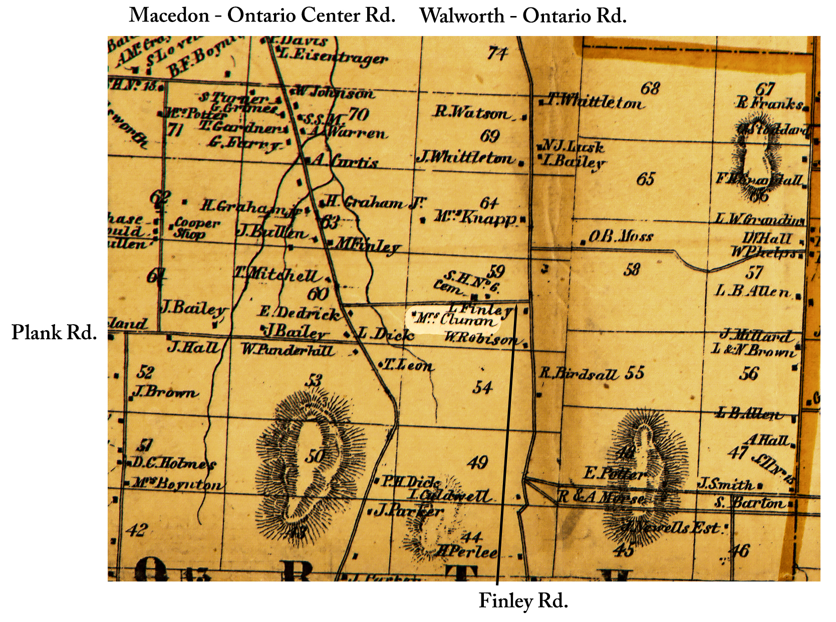 1858 Wayne County Wal-14a Ruins Excerpt Map.jpg ¹ | 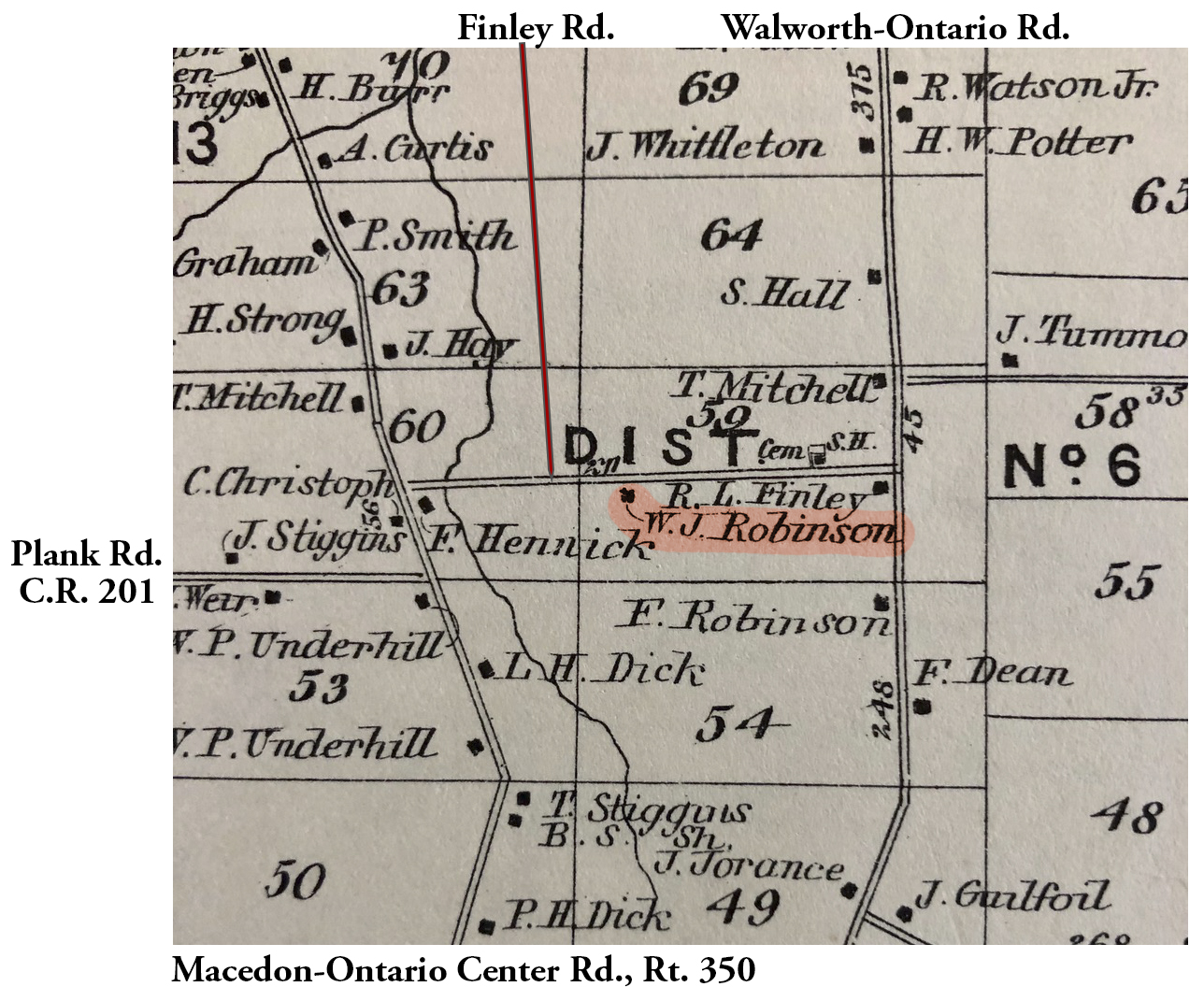 Finley Rd 1874 map.jpg ² | 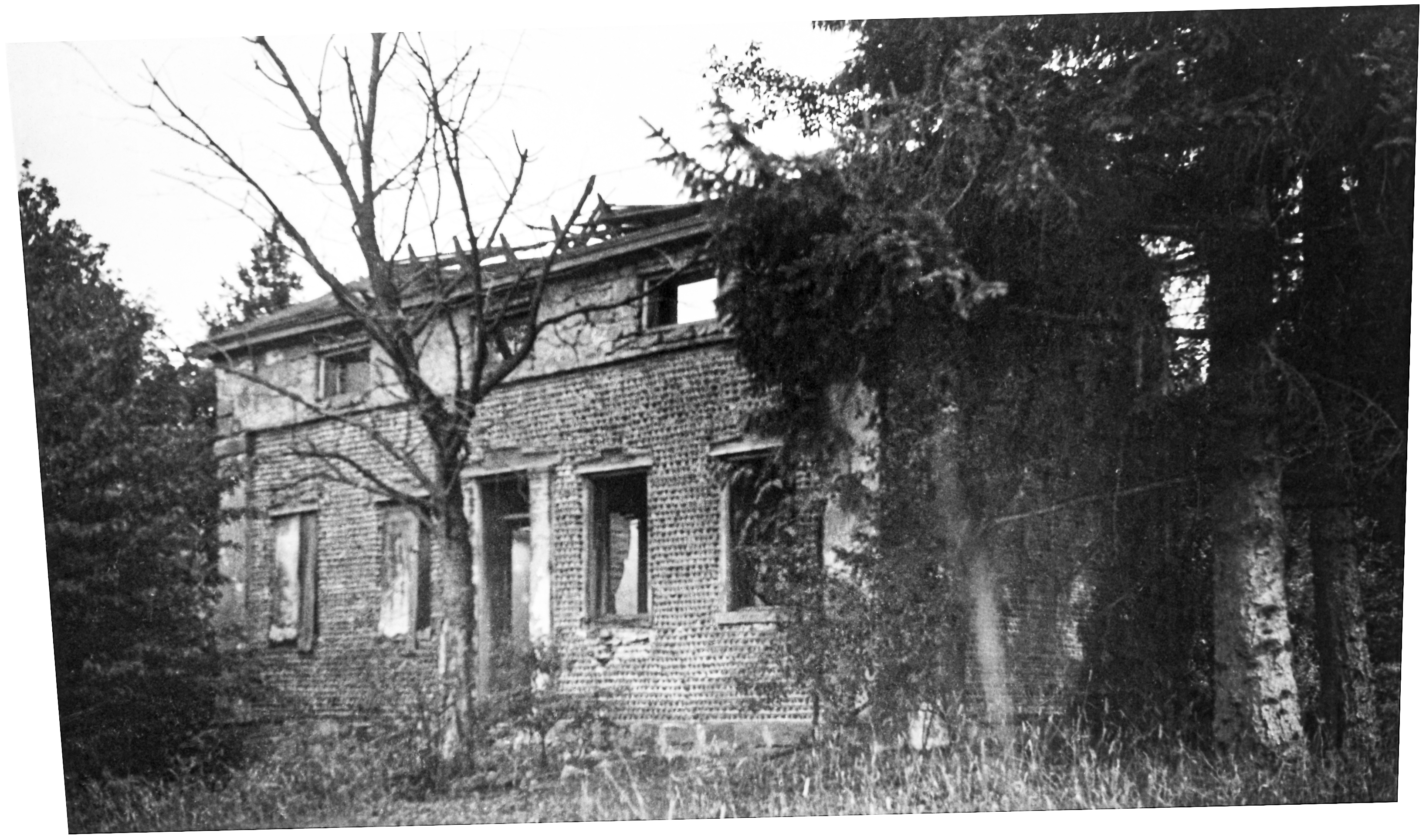 Wal-14 Unknown Ruins 1.jpg ³ Pease Collection 1940-41 | 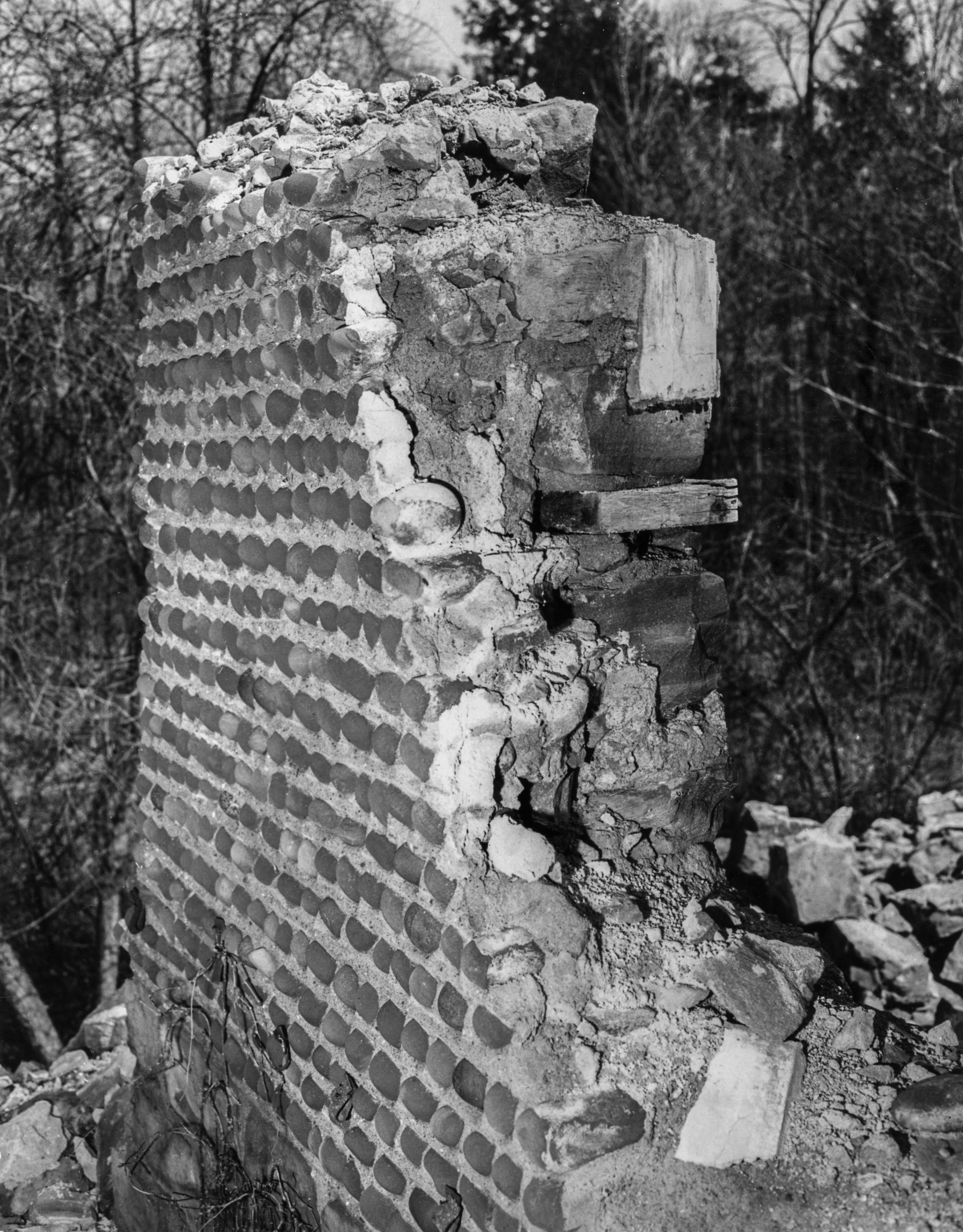 GP Wayne Walworth Wal-14 1-1 P.jpg 4 |
² 1874 Beers Atlas of Wayne County excerpt map courtesy Gene Bavis.
³ Image courtesy Cobblestone Museum.
4 Photography courtesy Gerda Peterich. Cobblestone Museum.
